Satopanth Tal Trek Itinerary
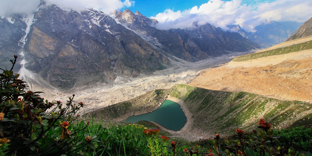
Satopanth Tal is a high-altitude glacial lake located in the Garhwal region of Uttarakhand, India. Nestled at an elevation of 4,600 metres (15,100 feet) above sea level, this trek is one of the most serene and spiritually significant in the Indian Himalayas. The name “Satopanth” is derived from two Sanskrit words: “Sato,” meaning truth, and “Panth,” meaning path. According to Hindu mythology, this lake is believed to be the spot where the holy trinity—Brahma, Vishnu, and Shiva—meditated on the path of truth. The lake is triangular in shape and is surrounded by towering peaks like Neelkanth (6,596 metres) and Chaukhamba (7,138 metres).
Geography and History
- Location: Satopanth Tal is located in the Chamoli district of Uttarakhand.
- Elevation: 4,600 metres (15,100 feet).
- Nearest Town: Badrinath, 22 km from Satopanth Tal.
- Historical Significance: The lake is considered sacred, and it is believed that only those with pure hearts can reach the lake.
- First Recorded Trek: The trek to Satopanth Tal was first documented by British explorers in the 1930s.
Weather Conditions
- Best Time to Visit: The trek is best undertaken between May and October. During this time, the weather is relatively mild, with daytime temperatures ranging from 10°C to 15°C.
- Weather Challenges: The trek can be challenging due to unpredictable weather, including sudden rains and snow at higher altitudes.
Short Itinerary
- Day 1: Badrinath to Laxmi Van (8 km)
- Day 2: Laxmi Van to Chakratirtha (10 km)
- Day 3: Chakratirtha to Satopanth Tal and back to Chakratirtha (10 km)
- Day 4: Chakratirtha to Badrinath (18 km)
This article will provide you with a detailed itinerary of the Satopanth Tal trek, covering the distances between each location, the best route to take, and alternative routes you can consider. We’ll also touch on the ideal times to visit and some tips to make your trek as enjoyable and safe as possible.
How to Reach Badrinath from Rishikesh and Haridwar
Reaching Badrinath, the starting point of the Satopanth Tal trek, is an adventure in itself, offering scenic views and opportunities for sightseeing along the way. The journey typically begins from either Rishikesh or Haridwar, two major towns well-connected by road and rail.
Route Overview:
- Haridwar to Badrinath: 320 km
- Rishikesh to Badrinath: 297 km
Transportation Modes:
- By Road: The most common way to reach Badrinath is by road. Buses and taxis are available from both Rishikesh and Haridwar.
- Rishikesh to Badrinath: 10-12 hours by car or bus.
- Haridwar to Badrinath: 11-13 hours by car or bus.
- By Road: The most common way to reach Badrinath is by road. Buses and taxis are available from both Rishikesh and Haridwar.
Sightseeing En Route:
- Rishikesh (0 km): Known as the “Yoga Capital of the World,” Rishikesh is a gateway to the Garhwal Himalayas. Popular attractions include Triveni Ghat, Laxman Jhula, and the Beatles Ashram.
- Devprayag (70 km from Rishikesh): The confluence of the Alaknanda and Bhagirathi rivers, marking the beginning of the Ganges River. It’s a great spot for a short break.
- Rudraprayag (140 km from Rishikesh): Another significant confluence, where the Alaknanda meets the Mandakini River. Rudraprayag is a picturesque town with a small market and temples.
- Karnaprayag (170 km from Rishikesh): The confluence of the Alaknanda and Pindar rivers. A small town with a bustling market and beautiful views.
- Joshimath (250 km from Rishikesh): A popular hill station and a base for trekkers heading to the Valley of Flowers and Hemkund Sahib. Joshimath is also known for the ancient Narasimha Temple and the Auli skiing slopes.
- Badrinath (297 km from Rishikesh): The final destination. Badrinath is a holy town and one of the four Char Dham pilgrimage sites. Before starting the trek, you can visit the Badrinath Temple and Tapt Kund (a natural hot water spring).
Day 1: Badrinath to Laxmi Van (8 km)
- Start Point: Badrinath (3,300 meters)
- End Point: Laxmi Van (3,800 meters)
- Distance: 8 km
- Trek Duration: 5-6 hours

Highlights:
- The trek begins from the sacred town of Badrinath. After paying your respects at the Badrinath Temple, you will cross the Mana village, the last inhabited village before the Indo-Tibetan border.
- The trail follows the Alaknanda River, offering stunning views of the surrounding peaks, including the majestic Neelkanth.
- After about 4-5 hours of trekking through rocky terrain, you will reach Laxmi Van, a beautiful campsite surrounded by lush greenery and towering peaks.
- Laxmi Van is known for its dense forests and the sight of blooming Brahma Kamal, a rare Himalayan flower.
Tips:
- Start early to avoid afternoon weather changes.
- Carry sufficient water and snacks, as there are no facilities along the trail.
Day 2: Laxmi Van to Chakratirtha (10 km)
- Start Point: Laxmi Van (3,800 meters)
- End Point: Chakratirtha (4,200 meters)
- Distance: 10 km
- Trek Duration: 6-7 hours
Highlights:
- The trek from Laxmi Van to Chakratirtha is moderately challenging, with steep ascents and descents.
- The trail offers panoramic views of snow-capped peaks, including the Chaukhamba and Balakun mountains.
- You will pass through dense forests, open meadows, and rocky terrains, with the occasional sighting of high-altitude wildlife.
- Chakratirtha is a large, open meadow surrounded by towering mountains. It is believed to be the spot where Lord Vishnu’s chakra fell during the cosmic battle.
Tips:
- Acclimatize well, as the altitude gain is significant.
- Set up camp early to explore the surroundings and enjoy the tranquil environment.
Day 3: Chakratirtha to Satopanth Tal and Back to Chakratirtha (10 km)
- Start Point: Chakratirtha (4,200 meters)
- End Point: Satopanth Tal (4,600 meters) and back to Chakratirtha
- Distance: 10 km (5 km one way)
- Trek Duration: 7-8 hours
Highlights:
- This is the most challenging day of the trek due to the high altitude and steep climb to Satopanth Tal.
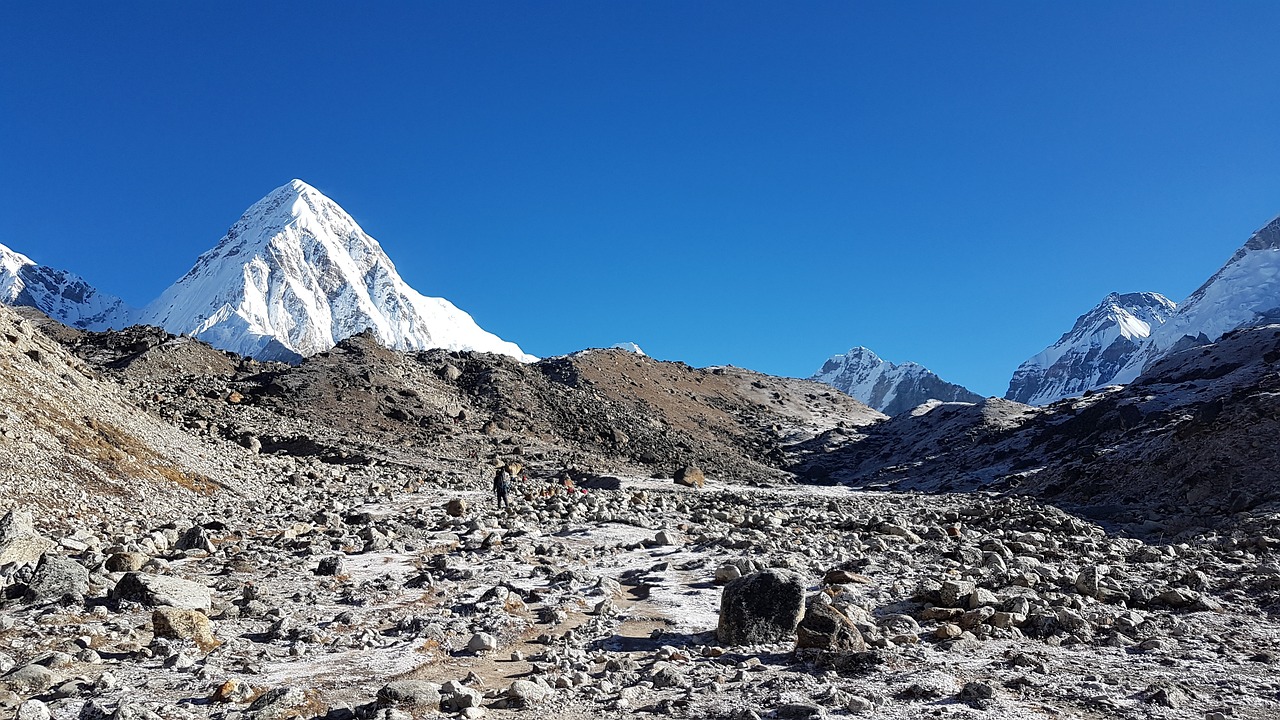
- The trail is marked by moraine and glacial debris, with breathtaking views of Chaukhamba, Neelkanth, and Swargarohini peaks.
- Satopanth Tal, the destination, is a crystal-clear, triangular lake, surrounded by towering peaks. The spiritual atmosphere of the lake is palpable, and the silence here is profound.
- After spending some time at the lake, you will retrace your steps back to Chakratirtha for the night.
Tips:
- Start early to make the most of the daylight.
- Carry extra layers as the temperature at the lake can drop significantly.
Day 4: Chakratirtha to Badrinath (18 km)
- Start Point: Chakratirtha (4,200 meters)
- End Point: Badrinath (3,300 meters)
- Distance: 18 km
- Trek Duration: 8-9 hours
Highlights:
- The final day of the trek involves descending back to Badrinath, retracing your steps through Laxmi Van and Mana village.
- The descent is easier on the lungs but can be tough on the knees, so take your time and enjoy the views.
- Once you reach Badrinath, you can relax and reflect on the spiritual and physical journey you’ve just completed.
- You may choose to visit the Badrinath Temple again to offer your thanks.
Tips:
- Use trekking poles to ease the descent.
- Make sure to stay hydrated and take breaks as needed.
This day-wise detailed itinerary will help you plan your Satopanth Tal trek, ensuring that you’re prepared for each day’s challenges and beauty.
Conclusion
The Satopanth Tal trek is not just a journey through the majestic landscapes of the Garhwal Himalayas but also a spiritual quest that resonates with the soul. From the holy town of Badrinath to the serene, triangular lake of Satopanth, every step of the trek offers a blend of natural beauty, rich mythology, and a sense of peace that is hard to find elsewhere. The trek, while challenging, rewards you with stunning views, unique flora, and the deep sense of accomplishment that comes from exploring one of the most remote and sacred spots in the Indian Himalayas.
Also Read valley of flower trek itinerary
20/08/2024
Mohit Bangari


