
Why Snowfall Is Becoming Less Predictable in the Himalayas: Causes, Climate Change and Uttarakhand's Changing Winters
– By Mohit Bangari
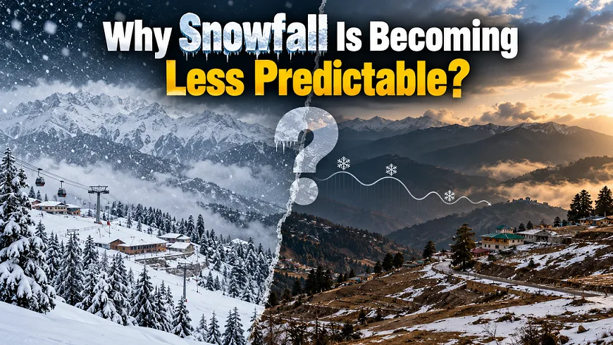
Table of Contents
Snowfall in the Himalayas is becoming less predictable. In some winters, popular hill stations wait for weeks before receiving their first snowfall. In other years, snow arrives in December but disappears quickly. Sometimes, the mountains receive heavy snowfall in January or February after a long dry spell.
Uttarakhand has experienced these changes in recent years. Auli, Mussoorie, Dhanaulti, Nainital and Munsiyari have all witnessed variations in the timing of snowfall. These changes affect tourism, skiing, farming, forests and the water resources of the Himalayan region.
However, the problem is not simply that snowfall is decreasing everywhere. The bigger concern is that the timing, amount, duration and location of snowfall are becoming more difficult to predict. Rising temperatures, changing Western Disturbances, shifting weather patterns and local geographical conditions all play a role.
Climate research also suggests that a larger share of winter precipitation in the Western Himalayas is falling as rain rather than snow. This change can affect how long snow stays on the mountains and how much water it stores for the coming months. A 2026 study published in the International Journal of Climatology examined winter precipitation across two 30-year periods and identified important changes in precipitation patterns and atmospheric circulation. Read the research on changing winter precipitation patterns.
In this article, we will explore the main reasons behind unpredictable snowfall, examine the snowfall patterns of recent winters in Uttarakhand, and understand what these changes mean for the future of the Himalayas.
What Does Unpredictable Snowfall Actually Mean?
Before understanding the causes, we must first understand what we mean by unpredictable snowfall.
Traditionally, winter in the higher Himalayan regions follows a seasonal pattern. Temperatures fall from November onwards. Western Disturbances bring rain and snowfall during winter. Snow accumulates on the mountains, and the snow cover generally remains for several weeks or months, depending on the altitude and weather conditions.
However, this pattern does not remain the same every year. Natural variations have always existed in the Himalayan climate.
The growing concern is that several factors are now interacting with this natural variation. As a result, the timing and nature of snowfall can differ considerably between winters.
Unpredictable snowfall can appear in several ways.
1. Delayed snowfall
Some destinations receive their first proper snowfall much later than expected. For example, Auli experienced its first snowfall of the 2023–24 winter season in January 2024, after an unusually dry period.
2. Early snowfall followed by a long dry spell
Sometimes, snowfall arrives in December and creates good conditions for winter tourism. However, the following weeks may remain dry. Without fresh snowfall, the existing snow gradually melts or becomes patchy.
3. Shorter snow cover duration
Even when snowfall occurs, warmer temperatures can cause snow to melt faster. Therefore, the total number of snowy days may decrease even if a destination receives some fresh snow.
4. Uneven snowfall across different locations
One mountain range may receive heavy snowfall while another receives very little. Even nearby destinations can experience different conditions because of altitude, slope direction, wind patterns and the path of a weather system.
5. Rain instead of snow
A winter weather system may bring rain to a hill station that would normally expect snowfall. At higher elevations, the same system may produce heavy snow.
6. Heavy snowfall after a prolonged dry period
A long period without snowfall does not mean that the rest of winter will remain dry. A strong Western Disturbance can bring heavy precipitation after several weeks of clear weather.
These differences explain why predicting snowfall for an entire winter has become difficult. A weather forecast may identify the possibility of precipitation, but the exact snowfall at a particular hill station depends on several local conditions.
1. Climate Change Is Raising Temperatures Across the Himalayas
Climate change is one of the major factors affecting snowfall in the Himalayan region.
The Himalayas are highly sensitive to temperature changes. Small differences in temperature can determine whether precipitation falls as rain, wet snow or dry snow.
When temperatures rise, the conditions required for snowfall become less common at some elevations.
For example, consider a hill station located at an altitude of around 2,000 metres. During a cold winter weather system, temperatures may remain low enough for snow to reach the ground. However, if the same weather system arrives under warmer conditions, the station may receive rain instead.
The weather system may bring moisture, clouds and precipitation, but the form of that precipitation can change.
This is particularly important for popular destinations such as Mussoorie, Nainital and the lower slopes around Auli.
How rising temperatures affect snowfall
There are several ways in which rising temperatures influence snowfall.
First, the snowline can move to higher elevations.
The snowline is the approximate elevation above which snow can accumulate and remain for a particular period. Its position changes with the season, temperature, precipitation and local geography.
When the atmosphere becomes warmer, locations that previously received snow may receive rain during some weather events.
Second, snow melts faster.
Fresh snow does not remain on the ground for the same duration everywhere. Its survival depends on temperature, sunlight, wind and the condition of the ground.
When daytime temperatures rise above freezing, snow can melt even if nights remain cold.
Third, the snowfall season can become shorter at some elevations.
If winter starts with relatively warm conditions and spring temperatures rise early, the period during which snow can accumulate and remain on the ground may become shorter.
Fourth, snowfall becomes more sensitive to small temperature changes.
A difference of even a few degrees can change the outcome of a weather system, especially at elevations close to the rain-snow transition zone.
Research on Western Himalayan climate patterns has identified rising temperatures and a declining proportion of precipitation falling as snow as important concerns. However, the exact changes differ across elevations and mountain ranges. Some high-altitude areas may continue to receive heavy snowfall even when lower locations experience less snow.
This means climate change does not prevent snowfall altogether. Instead, it changes the conditions under which snowfall occurs.
Is global warming the only reason for delayed snowfall?
No. This is an important distinction.
Global warming changes the background conditions in which weather systems operate. However, the timing of snowfall in a particular winter also depends on the movement and strength of Western Disturbances.
A winter can remain dry because suitable weather systems do not reach a region. Another winter can receive heavy snowfall when a strong system arrives at the right time.
Therefore, climate change and natural weather variations must be considered together.
2. Changing Western Disturbances Are Affecting Winter Snowfall
Western Disturbances are among the most important weather systems responsible for winter rain and snowfall across northern India.
These systems generally originate in the Mediterranean region and surrounding parts of western Eurasia. They move eastwards with the prevailing westerly winds and bring moisture to the Himalayas.
When a Western Disturbance reaches northern India, it can produce snowfall in the higher mountains and rainfall in the lower hills and plains.
For Uttarakhand, these systems are particularly important during winter.
They influence snowfall in Auli, Badrinath, Kedarnath, Gangotri, Yamunotri, Munsiyari and other high-altitude regions. Depending on their strength and movement, they can also bring snowfall to Mussoorie, Dhanaulti and the higher areas around Nainital.
However, Western Disturbances do not affect every part of the Himalayas equally.
What happens when a Western Disturbance misses Uttarakhand?
Imagine that a winter weather system passes north of Uttarakhand or remains too weak to bring sufficient moisture into the region.
The sky may remain clear for several days. Temperatures may fall at night, but the mountains receive little or no fresh snow.
This is one reason why a destination can experience cold weather without receiving snowfall.
For example, Auli experienced a prolonged dry period during December 2023 and early January 2024. Its first snowfall of that season arrived in January, and the lack of snow affected winter tourism.
The India Meteorological Department issued a special forecast on 30 January 2024 for an active Western Disturbance expected to affect Uttarakhand from 31 January to 1 February. The forecast highlighted the possibility of widespread rain and snowfall, including heavy to very heavy snowfall at some locations above 3,000 metres.
This illustrates an important point: after a long dry spell, a single active weather system can change mountain conditions within a short period.
Are Western Disturbances becoming weaker?
The answer is more complex than a simple yes or no.
A 2025 scientific review of Western Disturbances explains that their frequency, strength, tracks and seasonal influence can change differently across periods and locations.
Some research has found that the number of Western Disturbances or disturbance days can increase even when the number of systems following a particular track decreases.
In other words, counting weather systems alone does not tell us how much snowfall a region will receive.
The track of a disturbance, the amount of moisture it carries, its interaction with the mountains and the prevailing temperatures all matter.
A 2026 study of winter precipitation across the Western Himalayan region also found that changes in atmospheric circulation and the northward shift in the density of Western Disturbance tracks were associated with declining large-scale winter precipitation.
These findings suggest that the behaviour of Western Disturbances is an important part of the changing snowfall pattern.
For further reading, see the scientific review Western Disturbances and Climate Variability: A Review of Recent Developments.
3. More Winter Precipitation Is Falling as Rain Instead of Snow
Another major concern is the changing form of winter precipitation.
Precipitation means water that falls from the atmosphere. It includes rain, snow, sleet and other forms of water reaching the ground.
In mountain regions, temperature plays a major role in determining which form occurs.
When atmospheric conditions are sufficiently cold, precipitation falls as snow. When temperatures are warmer, it may fall as rain.
The transition is not determined by one fixed temperature at every location. Humidity, atmospheric layers, the height of the freezing level and local weather conditions also influence the result.
Why does the rain-snow transition matter?
Suppose a Western Disturbance brings 20 mm of precipitation to a mountain region.
During a colder winter, much of this precipitation may fall as snow at a particular elevation. During a warmer winter, the same location may receive rain or wet snow.
The total precipitation could be similar, but the effect on the landscape would be different.
Snow accumulates on the ground and can remain there for weeks or months. Rain generally flows downhill more quickly, although some water enters the soil and groundwater system.
Snow also delays the release of water into rivers until melting begins.
Therefore, a change from snowfall to rainfall can alter the timing of water availability.
What does recent research say?
A study published in the International Journal of Climatology in March 2026 compared winter precipitation patterns across the Western Himalayan region during 1961–1990 and 1993–2022.
The researchers found that large-scale winter precipitation had declined more noticeably than convective precipitation. They also reported that a greater share of precipitation was falling as rain rather than snow.
The study linked these changes to rising temperatures, changes in vertical atmospheric movement and shifts in Western Disturbance tracks.
This finding is important because it shows that the problem is not simply about the amount of precipitation. Its form is also changing.
However, the study covers a broad Himalayan region. Its findings should not be treated as an exact measurement of snowfall loss at every Uttarakhand hill station.
Why are lower hill stations more sensitive?
Locations at lower elevations often experience temperatures closer to the rain-snow transition point.
As a result, a small rise in temperature can change the form of precipitation.
At higher elevations, temperatures may remain low enough for snow to fall during the same weather system.
This explains why a winter storm can bring rain to Mussoorie or Joshimath while producing snowfall in Auli’s higher areas or on the mountains around Badrinath.
The difference depends on the actual atmospheric conditions during the event.
4. Long Dry Periods Between Western Disturbances
Snowfall does not depend only on how much precipitation a region receives during the entire winter. The intervals between precipitation events also matter.
A mountain may receive a good amount of snow during one storm but remain dry for the next two or three weeks.
During this period, sunlight, wind and above-freezing temperatures can gradually reduce the snow cover.
This creates a pattern of sudden snowfall followed by a long dry spell.
Why are dry spells a problem?
Fresh snowfall covers the ground with a new layer of snow. However, without further snowfall, this layer gradually changes.
Sunlight warms the surface. Wind moves loose snow from exposed slopes to other areas. Warmer air increases melting, while rain can speed up snow loss under some conditions.
The result is uneven snow cover.
One slope may retain snow because it receives less direct sunlight. Another slope at the same elevation may become bare much earlier.
For ski resorts, this creates additional problems. A destination may receive enough snow to look beautiful for a few days but not enough to maintain suitable skiing conditions throughout the season.
The role of December and January
December is an important month for winter tourism in Uttarakhand. Many visitors plan their trips around Christmas and New Year.
However, the arrival of winter does not guarantee that every hill station will receive snow.
If the early winter remains dry, tourists may find green slopes instead of snow-covered landscapes.
January and February often provide better opportunities for snowfall in many Himalayan destinations, but they are not guaranteed snow months either.
The actual conditions depend on the weather systems that reach the region.
Therefore, the first snowfall, the first widespread snowfall and the period of maximum snow cover should be treated as three different events.
A destination may receive a few snowflakes in December but experience its main snowfall in late January. Another may receive early snow but lose much of it before the main tourist season.
5. The Jet Stream and Large-Scale Atmospheric Changes
The jet stream is a narrow band of strong winds in the upper atmosphere. It plays an important role in the movement of weather systems, including Western Disturbances.
The position and strength of the subtropical westerly jet can influence the tracks followed by these disturbances.
When the atmospheric circulation changes, Western Disturbances may follow different paths or affect the Himalayas at different times.
This can change the amount and distribution of winter precipitation.
How does the jet stream affect Uttarakhand?
Western Disturbances travel with the larger atmospheric circulation. Their movement determines whether they bring moisture and favourable conditions to Uttarakhand.
If a disturbance passes along a track that mainly affects areas farther north, Uttarakhand may receive less precipitation.
If the system moves along a suitable track and interacts with moist air and the Himalayan terrain, it may produce widespread snowfall.
The strength and position of the jet stream also influence the development and movement of these weather systems.
Recent research has examined changes in the seasonal influence of Western Disturbances. Some findings indicate that these systems are becoming more influential during the pre-monsoon period in certain parts of the Himalayas.
This does not mean every disturbance is moving in the same direction or that every winter will become snowless.
Instead, the research highlights how changes in large-scale atmospheric circulation can affect the timing and distribution of precipitation.
It also explains why snowfall cannot be predicted by looking at local temperature alone.
6. Rising Winter Temperatures Are Making Snow Cover Less Stable
Snowfall and snow cover are two different things.
Snowfall refers to fresh snow falling from the atmosphere. Snow cover refers to the snow already lying on the ground.
A location may receive snowfall but still experience poor snow cover if the snow melts quickly.
This difference is especially important when comparing winters in the Himalayas.
Why does snow disappear quickly?
Snow cover depends on several factors:
Air temperature during the day and night.
The amount of direct sunlight received by the slope.
The depth and density of the snow.
Wind speed and direction.
Rain falling on the existing snow.
Ground temperature and the condition of the underlying surface.
For example, a shaded slope may retain snow for longer than a sunny slope nearby.
Similarly, a deep layer of snow generally takes longer to disappear than a thin layer under comparable conditions.
However, snow depth alone does not determine how long the snow will survive.
Why is this important for Auli?
Auli is one of India’s well-known skiing destinations. It attracts tourists because of its mountain views, snow-covered slopes and skiing opportunities.
However, skiing requires more than a single snowfall event.
The slopes need sufficient snow cover, and the snow must remain in suitable condition. If the snowfall arrives late or temperatures rise soon afterwards, the usable skiing period may become shorter.
This can affect ski schools, hotels, restaurants, equipment rental businesses and local workers.
If you are planning a trip, read our detailed guide to Auli Winter 2026–27: Snowfall, Skiing, Weather and Travel Guide. It is also useful to understand how conditions differ between destinations through our guide to Auli vs Gulmarg: Which Is the Best Ski Destination in India?.
7. The Himalayan Mountains Create Different Weather Conditions at Nearby Locations
The Himalayas have extremely varied terrain. Their mountains, valleys, ridges and slopes influence how weather systems behave.
As a result, snowfall is not distributed evenly across the region.
Two locations at similar elevations may receive different amounts of snow because they lie on different sides of a mountain range.
The role of mountain barriers
When moist air moves towards the Himalayas, the mountains force it to rise.
As the air rises, it cools. Under suitable conditions, water vapour condenses and precipitation develops.
However, the amount of precipitation depends on the direction of the incoming air, the moisture available and the structure of the weather system.
One valley may receive substantial precipitation while another remains comparatively dry.
This effect can occur even during the same Western Disturbance.
Why does snowfall differ between Garhwal and Kumaon?
Uttarakhand includes several mountain ranges and valleys with different geographical conditions.
In Garhwal, places such as Auli, Badrinath, Kedarnath and Harsil occupy different elevations and positions within the mountain system.
In Kumaon, Munsiyari, Mukteshwar, Nainital and the higher ridges around them also experience different local conditions.
Therefore, the arrival of snowfall at one location does not guarantee snowfall at another.
The same principle applies within individual hill stations.
A higher ridge may receive snow while the main town receives rain. A shaded forest area may retain snow even after exposed slopes become bare.
This geographical variation is a natural feature of Himalayan weather. However, changing temperatures and precipitation patterns can make the differences more noticeable.
8. Why Does Snowfall Sometimes Arrive Suddenly After Weeks of Dry Weather?
One of the most confusing features of Himalayan winters is the sudden arrival of heavy snowfall after a long dry period.
This happens because dry weather and heavy snowfall are not mutually exclusive.
A region may remain dry for several weeks if suitable Western Disturbances do not affect it. Later, a strong disturbance can bring moisture, clouds and intense precipitation.
If temperatures are sufficiently low, the precipitation can fall as snow over a large area.
Three factors determine the outcome
The strength of the weather system: A stronger disturbance may produce more widespread precipitation.
The availability of moisture: A system needs sufficient moisture to generate substantial precipitation.
The temperature profile: The atmosphere must support snowfall at the elevation being considered.
These factors can change independently.
A strong disturbance may bring heavy rain at lower elevations and snow at higher elevations. Another system may bring widespread snow if temperatures are lower.
This is why the absence of snowfall in December cannot tell us exactly what will happen in January or February.
However, a sudden heavy snowfall also creates risks.
When fresh snow accumulates rapidly, it can increase avalanche danger in exposed mountain areas. Heavy precipitation may also disrupt roads, trekking routes and other transport facilities.
Therefore, a good snowfall season does not always mean safer mountain conditions.
9. How El Niño, La Niña and Other Climate Patterns Influence Snowfall
Large-scale climate patterns can influence winter weather over India.
Two widely discussed patterns are El Niño and La Niña, which form part of the El Niño–Southern Oscillation, or ENSO.
These patterns involve changes in sea-surface temperatures and atmospheric circulation across the tropical Pacific Ocean.
They can influence weather over different parts of the world, including the Indian subcontinent.
However, their influence on Himalayan snowfall is complex.
Does El Niño always reduce snowfall in Uttarakhand?
No. It would be incorrect to say that every El Niño winter brings less snow to Uttarakhand.
ENSO can influence large-scale atmospheric circulation, but its effects depend on the season and the interaction with other climate systems.
The Indian winter climate is also influenced by Western Disturbances, the subtropical jet stream, regional moisture conditions and temperature variations.
As a result, two El Niño years can produce different snowfall outcomes.
La Niña does not guarantee heavy snowfall either.
Why should we consider these climate patterns?
Large-scale climate patterns help scientists understand the background conditions in which weather systems develop.
They can provide useful information for seasonal forecasting. However, they cannot independently predict the exact date or quantity of snowfall at Auli, Mussoorie or Munsiyari.
For a particular destination, local forecasts and observations remain important.
It is also necessary to distinguish between a seasonal climate influence and the immediate cause of a snowfall event.
A Western Disturbance may be the direct reason for snowfall, while larger climate patterns may influence the broader atmospheric conditions.
10. What Has Changed in Uttarakhand’s Snowfall Patterns in Recent Years?
Recent winters provide useful examples of how snowfall timing can vary from one year to another.
The following examples focus on the 2023–24, 2024–25 and 2025–26 winter seasons.
These observations show considerable variation in the timing of snowfall. However, three winters alone cannot establish a long-term climate trend. To understand a trend, scientists need longer records of snowfall, temperature, precipitation and snow cover.
Winter 2023–24: Delayed Snowfall in Auli and Mussoorie
The winter of 2023–24 was marked by a prolonged dry spell across parts of Uttarakhand.
Auli, one of the state’s major winter tourism destinations, experienced a particularly difficult start to the season.
According to a report published by India Today on 18 January 2024, Auli received its first snowfall of that winter on 16 January after an unusually dry period. The lack of fresh snow had already affected tourists and local businesses.
Visitors who had arrived expecting snow were disappointed. Some hotels and restaurants also experienced reduced tourist activity.
The situation improved towards the end of January and the beginning of February.
On 30 January, the India Meteorological Department issued a forecast for an active Western Disturbance expected to bring rain and snowfall to Uttarakhand from 31 January to 1 February.
The resulting weather system brought fresh snowfall to several higher Himalayan areas. Mussoorie and Nainital also received snowfall around the beginning of February after a prolonged dry spell.
This winter demonstrates two important features of changing snowfall patterns.
First, the first significant snowfall can arrive later than visitors expect.
Second, snowfall can occur across several destinations within a short period when an active weather system reaches the region.
What does this tell us?
The experience of 2023–24 shows why December snowfall cannot be taken for granted. It also shows that a dry start to winter does not rule out snowfall later in the season.
Sources: India Today: Auli’s delayed first snowfall in January 2024 and IMD’s special weather forecast of 30 January 2024.
Winter 2024–25: Early Snowfall but Uneven Conditions
The following winter presented a different picture.
December 2024 recorded substantially more rainfall than December 2023. A report published in January 2026, using IMD data, noted that Uttarakhand’s December 2024 rainfall was 89% above normal.
Snowfall also occurred in several mountain destinations during December 2024.
Reports described snowfall around Auli, Mussoorie, Munsiyari and higher areas near Nainital during the month. Additional snowfall occurred during later winter weather systems.
However, early snowfall did not automatically guarantee ideal conditions throughout the skiing season.
A ski resort needs suitable snow depth and a sufficiently continuous snow cover. Fresh snowfall can improve conditions, but its benefits depend on how much snow accumulates and how quickly it melts.
The winter of 2024–25 therefore provides an important contrast with the previous season.
In 2023–24, Auli waited until January for its first snowfall. In 2024–25, snow arrived much earlier.
This variation shows that the first snowfall date can shift considerably between winters.
It also highlights why seasonal snowfall cannot be judged by one weather event alone.
What does this tell us?
Early snowfall is encouraging for tourism, but it is not a guarantee of continuous snow cover. The timing, depth and persistence of snow all matter.
Source: Times of India: Uttarakhand’s December rainfall variations and IMD observations.
Winter 2025–26: A Very Dry Start Followed by Late Snowfall
The winter of 2025–26 provided another example of a delayed snowfall season.
According to the Indian Institute of Remote Sensing (IIRS), Uttarakhand experienced a pronounced snow-cover deficit during parts of late November and December 2025.
The institute’s analysis compared satellite-derived snow cover with a long-term reference based on observations from 2000 to 2025.
Between 20 November and 30 December 2025, approximately 45% to 75% of the assessed area in Uttarakhand showed snow-deficit conditions during the relevant observation periods.
This does not mean that every location across the state had the same snow deficit. It indicates that snow cover was below the long-term reference over a substantial part of the assessed region.
The situation began to improve towards late December and early January, but snow cover remained below the long-term mean during much of the study period.
The dry conditions also raised concerns about soil moisture, river flows and forest-fire vulnerability.
Later snowfall brought relief to several destinations. Reports from January 2026 described fresh snow across parts of Garhwal and Kumaon, including Auli, Mussoorie, Dhanaulti, Munsiyari and higher Himalayan areas.
However, the timing of this snowfall meant that the season began under very different conditions from those of 2024–25.
What does this tell us?
The 2025–26 winter shows why snowfall must be studied over an entire season. A dry November and December can be followed by fresh snowfall in January, but late snowfall cannot always compensate fully for the earlier lack of snow and moisture.
Recent Snowfall Patterns at a Glance
| Winter season | Auli | Mussoorie and Nainital | Main observation |
|---|---|---|---|
| 2023–24 | First snowfall reported in mid-January 2024 | Snowfall reported around the beginning of February 2024 | Prolonged dry spell followed by late snowfall |
| 2024–25 | Snowfall reported in December 2024 | Snowfall reported in December and during later winter events | Earlier snowfall, but snow cover still depended on subsequent weather |
| 2025–26 | Widespread snowfall reported in January 2026 | Snowfall reported during January 2026 | Very dry early winter followed by later snowfall |
Note: This table summarises reported snowfall events, not a complete measurement of snowfall depth or duration. The exact dates and amounts differ between locations. The examples illustrate recent variability rather than proving that every hill station is experiencing the same long-term trend.
11. Why Is Snowfall Becoming Unpredictable in Mussoorie and Nainital?
Mussoorie and Nainital are among the most popular winter destinations in Uttarakhand.
Both towns attract large numbers of tourists who hope to experience snowfall. However, snowfall at these destinations is not guaranteed every winter.
Their elevations and local weather conditions make them more sensitive to changes in temperature than many high-altitude Himalayan locations.
Mussoorie
Mussoorie is located at a lower elevation than many major Himalayan snow destinations.
Snowfall depends on the strength of the weather system, the temperature profile and the elevation of the surrounding slopes.
Sometimes, higher areas around Mussoorie receive snow while the main town experiences rain.
During the winter of 2023–24, Mussoorie received snowfall around the beginning of February after a prolonged dry period.
This illustrates why visitors cannot assume that Christmas, New Year or early January will always bring snow.
Nainital
Nainital also experiences considerable variation in snowfall.
The higher ridges around the town, including areas near Naina Peak, may receive snow under conditions that do not produce snowfall around the lake.
Even when snow falls, its duration depends on temperature, sunlight and the depth of accumulation.
The winter of 2023–24 saw snowfall around the beginning of February, while the following winter brought snowfall to the region earlier in the season.
These differences show that snowfall timing can shift from one winter to another.
What should tourists understand?
The main lesson is simple: a cold winter day does not guarantee snowfall.
Tourists should check short-range weather forecasts before travelling. They should also distinguish between forecasts for a district, a high mountain range and the actual town they plan to visit.
A forecast of snowfall in the higher reaches of Uttarakhand does not necessarily mean that Mussoorie or Nainital will receive snow.
12. Why Does Auli Need Special Attention?
Auli is an important example because snowfall directly affects its winter tourism and skiing activities.
Unlike destinations where visitors mainly want to see snow, Auli also depends on suitable snow cover for winter sports.
The timing and duration of snowfall influence the working season of ski schools, hotels, equipment rental businesses and local guides.
Snowfall is not the same as skiing conditions
A short snowfall can make Auli look beautiful. However, professional skiing requires suitable snow depth across the slopes.
Several factors determine whether skiing conditions remain favourable:
The total amount of snow accumulated.
The distribution of snow across the ski slopes.
The temperature after snowfall.
The frequency of fresh snowfall.
The rate at which existing snow melts.
The condition and preparation of the skiing surface.
If snow arrives late, ski schools may have fewer suitable days to conduct courses.
Similarly, an early snowfall followed by a long dry spell may not provide the same conditions as repeated snowfall throughout winter.
What can Auli expect in the future?
The future of snowfall in Auli will depend on both natural weather variability and longer-term climate changes.
The region may continue to experience good snowfall in some winters. However, rising temperatures could make snow cover less reliable, particularly during warmer periods.
It is important not to assume that Auli will stop receiving snow. The more realistic concern is that the timing, depth and persistence of snow may become less dependable.
For visitors, this means that flexible travel dates and updated weather information are becoming increasingly useful.
For the skiing industry, it means that long-term planning should account for the possibility of shorter or more variable snow seasons.
13. How Unpredictable Snowfall Affects Himalayan Tourism
Winter tourism supports many families across Uttarakhand.
Hotels, homestays, restaurants, taxi operators, guides, ski instructors and equipment rental businesses depend on visitors during the winter season.
When snowfall arrives late, these businesses can face financial difficulties.
Losses for hotels and local businesses
Many tourists book their winter holidays specifically to see snow.
If a destination remains snowless during December or early January, some visitors may cancel their plans or choose another location.
This affects hotel occupancy, restaurant sales and other tourism services.
Businesses that depend on winter sports can face even greater uncertainty because their main activity requires suitable snow conditions.
Changes in travel planning
In the past, many travellers planned their trips around traditional winter dates.
However, recent snowfall variations show why booking a trip months in advance does not guarantee snow.
Tourists should monitor forecasts closer to their travel dates and remain flexible where possible.
Travel businesses can also provide more accurate information by clearly distinguishing between expected snowfall, existing snow cover and confirmed skiing conditions.
The importance of sustainable tourism
Snowfall uncertainty also creates an opportunity to promote other aspects of Himalayan tourism.
Visitors can explore local culture, village life, traditional food, mountain walks and heritage sites alongside winter activities.
However, alternative tourism should not become an excuse to ignore environmental concerns. Sustainable tourism must protect local water sources, forests and fragile mountain ecosystems.
14. How Changing Snowfall Affects Water Resources in Uttarakhand
Snowfall is not only important for tourism. It is also an essential part of the Himalayan water system.
Snow accumulates on mountain slopes during winter and gradually melts as temperatures rise.
This meltwater contributes to streams and rivers and helps maintain water availability during warmer months.
The amount of water released depends on the quantity of snow, its location, the timing of melting and other environmental conditions.
Why does winter snowfall matter for rivers?
When snow remains on the mountains for a long period, it acts as a temporary water store.
As temperatures rise in spring and summer, the snow melts and releases water gradually.
However, if more precipitation falls as rain instead of snow, some water may reach rivers earlier.
Similarly, if snow melts earlier because of warmer temperatures, the timing of water availability may change.
This does not mean that every river will immediately experience lower flow. River discharge also depends on rainfall, glacier melt, groundwater and other factors.
Nevertheless, changes in snow accumulation and melting can influence the seasonal distribution of water.
What does this mean for the Upper Ganga basin?
The Upper Ganga basin includes areas influenced by seasonal snow cover and glacier melt.
Changes in snowfall can affect the timing of water entering streams and rivers.
If winter precipitation remains low, soil moisture and water availability in some areas may suffer. The impact will vary according to the location, altitude and dependence of local communities on snowmelt and winter precipitation.
The IIRS analysis of the 2025–26 winter highlighted concerns about declining river flows in much of the Upper Ganga basin during the assessed period.
This is an important reminder that snowfall patterns must be considered alongside rainfall, glacier conditions and groundwater recharge.
15. Why Less Snow Can Increase Forest-Fire Risks
Winter snowfall also influences forest conditions.
When the winter remains dry, forests and grasslands receive less moisture. Soil moisture can decline, while fallen leaves, dry grass and other vegetation remain available as fuel.
If dry conditions continue into spring, these materials can contribute to forest-fire risk.
This is particularly relevant in Uttarakhand, where forest fires frequently become a concern during the warmer months.
How does snowfall help?
Snowfall can add moisture to the landscape. When snow melts, some of the water enters the soil and supports vegetation, depending on the local conditions.
However, snow is only one part of the moisture cycle. Rainfall, humidity, soil characteristics and vegetation also influence forest-fire risk.
A snow-deficient winter does not automatically lead to a severe forest-fire season, but it can add to the problem when other conditions are dry.
The IIRS assessment of the 2025–26 winter identified a connection between early-winter dryness, below-normal snow cover and increased forest-fire vulnerability.
The study also noted fire activity in several forest belts during October, November and December 2025.
This suggests that winter moisture conditions deserve attention when preparing for the following fire season.
16. What Does Unpredictable Snowfall Mean for Himalayan Wildlife?
Snowfall and temperature changes can also influence wildlife.
Animals living in the Himalayas depend on particular habitats, seasonal food sources and suitable environmental conditions.
Changes in snow cover may affect vegetation, access to food and movement across mountain slopes.
However, the effects differ between species and locations.
Some animals are adapted to deep snow, while others prefer forest areas or lower elevations during winter.
Changes in food availability
When winter conditions change, plants may grow or become available at different times.
These changes can influence the food available to herbivores and other wildlife.
Predators may also respond to changes in the distribution of their prey.
The effects can extend across the food chain, although the precise outcome depends on local ecological conditions.
Why should Uttarakhand monitor these changes?
The state contains a wide range of habitats, from subtropical forests to alpine meadows and high mountain landscapes.
Each habitat responds differently to changing temperature and snow cover.
Long-term monitoring can help researchers understand whether wildlife is changing its movement patterns, habitat use or seasonal behaviour.
However, it is important not to attribute every change in wildlife behaviour to snowfall alone. Human activity, habitat loss, food availability and other environmental factors also play important roles.
17. Can Scientists Predict Snowfall Accurately?
Weather forecasting has improved significantly because of better satellites, computer models and atmospheric observations.
However, forecasting snowfall in a mountainous region remains difficult.
The Himalayas have complex terrain. Weather conditions can change over short distances, and a small difference in temperature can change whether precipitation falls as rain or snow.
Short-range weather forecasts
Forecasts for the next few days can provide useful information about approaching Western Disturbances, expected precipitation and temperature changes.
These forecasts are particularly helpful when a weather system is already approaching the region.
However, the exact snowfall amount at a particular village or hill station may remain uncertain.
Seasonal forecasts
Seasonal forecasts attempt to identify broader patterns over several weeks or months.
They can help indicate whether conditions may be warmer, colder, wetter or drier than normal.
However, they cannot reliably tell visitors the exact date on which snow will fall at Auli or Mussoorie several months in advance.
The role of satellite observations
Satellites help scientists monitor snow cover over large and remote mountain areas.
They can identify where snow is present and compare current conditions with historical averages.
This is especially useful in the Himalayas, where many locations lack long-term ground-based snow measurements.
However, satellite-derived snow cover is not the same as direct measurement of snowfall depth at every location.
A satellite may show that an area is snow-covered, but further observations are needed to determine the snow’s depth, density and water content accurately.
What should travellers do?
Anyone planning a snow trip should follow these simple steps:
Check the latest forecast issued by the India Meteorological Department.
Look for forecasts specific to the destination rather than relying only on a state-wide prediction.
Confirm whether snowfall has actually occurred.
Ask local authorities or accommodation providers about current road and snow conditions.
Keep travel dates flexible when possible.
Avoid entering avalanche-prone areas without proper guidance and safety information.
The key is to use forecasts as guidance rather than treating them as a guarantee.
18. What Can Be Done to Prepare for Changing Snowfall Patterns?
Unpredictable snowfall is a regional climate and weather challenge. It cannot be solved by one measure alone.
However, several steps can help communities, tourism businesses and government departments prepare for changing conditions.
Better snowfall monitoring
More weather stations and regular snow-depth observations can improve the understanding of local snowfall patterns.
Long-term records are especially important because they help researchers distinguish natural variation from persistent changes.
Better local forecasts
Forecasts that consider elevation and local geography can help tourists and businesses make better decisions.
For example, a forecast for the higher slopes above a town may not accurately represent conditions in the town itself.
More location-specific information would improve winter travel planning.
Sustainable tourism planning
Tourism businesses should avoid depending entirely on one weather condition.
Destinations can promote local food, culture, village experiences, heritage and other outdoor activities alongside snow-based tourism.
At the same time, tourism infrastructure should use water and other natural resources responsibly.
Protecting forests and water sources
Forest conservation, catchment protection and careful management of local water sources can help reduce some environmental pressures.
These measures cannot prevent global warming or guarantee snowfall, but they can improve the resilience of Himalayan communities.
Supporting climate research
Scientists need long-term observations of temperature, precipitation, snow cover and snowmelt.
These records can help improve forecasts and identify areas that are particularly sensitive to changing snowfall patterns.
19. Will Uttarakhand Stop Receiving Snowfall in the Future?
There is no scientific basis for claiming that snowfall will completely disappear from Uttarakhand.
The state contains mountains at different elevations, and its high Himalayan regions can continue to receive substantial snowfall under suitable weather conditions.
However, the future may not look the same at every elevation.
Lower hill stations may become more sensitive to warming because their temperatures are closer to the rain-snow transition zone.
Higher mountain areas may continue to receive snow, although their snowfall, snow cover and melting patterns can also change.
Some winters may still bring heavy snowfall. Others may remain unusually dry.
The important question is not whether snow will disappear entirely. It is whether the timing, amount and duration of snow will remain reliable enough for ecosystems, water resources and winter tourism.
Research suggests that rising temperatures can reduce the proportion of winter precipitation falling as snow across parts of the Western Himalayas.
However, future snowfall will also depend on changes in atmospheric circulation, moisture availability and local geography.
Therefore, the most reasonable expectation is continued variation, with increasing concern about snow reliability in some locations.
20. Why Should We Compare Uttarakhand With Other Himalayan Regions?
Snowfall patterns across the Himalayas are connected through larger atmospheric systems, but the conditions are not identical everywhere.
Comparing different regions can help us understand how altitude, geography and climate influence snowfall.
For example, Auli in Uttarakhand and Gulmarg in Jammu and Kashmir both depend on winter snowfall for skiing. However, their weather conditions, elevations and local climates differ.
A winter that produces limited snow at one destination may produce different results at another.
Similarly, trekking regions in Nepal and the Pir Panjal range experience their own combinations of altitude, precipitation and temperature.
These differences are important when comparing winter tourism destinations.
For readers interested in other Himalayan mountain environments, our guides to the Everest Base Camp Trek itinerary and the Pir Panjal Lakes Trek itinerary provide useful starting points for exploring different parts of the Himalayan region.
However, conditions at these destinations should not be used as direct evidence of snowfall trends in Uttarakhand. Each region needs its own weather observations and long-term climate records.
Conclusion: The Future of Snowfall in the Himalayas
Snowfall has always varied across the Himalayas. Some winters bring heavy snow, while others remain relatively dry.
However, recent winters in Uttarakhand highlight why snowfall timing and snow cover deserve closer attention.
Auli received its first snowfall of the 2023–24 winter in January 2024. The following winter brought snowfall much earlier, including in December 2024. The 2025–26 winter then began with a major snow-cover deficit before later snowfall improved conditions in several locations.
These examples show how much the start of winter can differ from one year to another.
Climate change is an important part of the explanation. Rising temperatures can shift the rain-snow boundary, increase melting and shorten the period during which snow remains on the ground.
At the same time, Western Disturbances and large-scale atmospheric circulation determine when moisture reaches the Himalayas. Mountain geography creates further differences between nearby destinations.
Therefore, unpredictable snowfall is not the result of one single cause. It reflects the interaction of climate change, natural weather variability, atmospheric circulation and local conditions.
The consequences extend beyond tourism. Snowfall affects water availability, forest moisture, mountain ecosystems and the livelihoods of people who depend on winter tourism.
For Uttarakhand, the need of the hour is better snowfall monitoring, more reliable local forecasts and long-term planning for changing winter conditions.
The Himalayas will continue to experience snowfall, but the timing and reliability of that snowfall may become increasingly important challenges for the coming generations.
By Mohit Bangari
(28 October 2026)
Related Post





Explore the beauty and cultures of the Himalayas, from Jammu and Kashmir to Arunachal Pradesh, Tibet and Nepal. My blog shares stories, pictures, and fun articles about this amazing region. Come along on a journey where each mountain has a tale and every valley hides a treasure. Join me as I discover the magic of the mountains together.
Welcome to my Himalayan Adventure!